Data Store
für Architektur,
Stadt- und Landschaftsplanung
CAD-compatible Geodata for your needs
Our Products
Our geospatial data help you with presentations, analyses and planning projects.
Save time and effort in researching, designing and creating the base for your projects.
Find out more about our individual solutions:
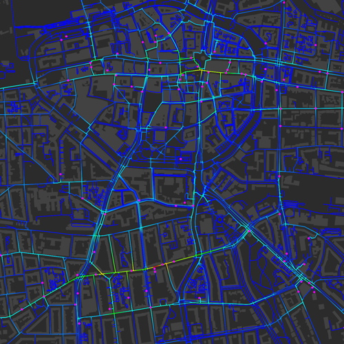
Map Layer
Stellen Sie räumliche Kartenebenen jeder Stadt und Region europaweit individuell nach Ihrem Bedarf zusammen.
Data Layers
Finden Sie raumbezogene Informationen aus einer Vielzahl unterschiedlicher Themen und Anwendungsfelder - strukturiert und gesammelt an einer Stelle.
Background Maps
Ready-to-use base maps of any location as an information basis for your work process and presentations.
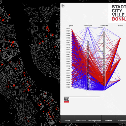
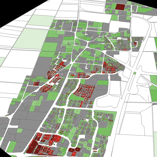
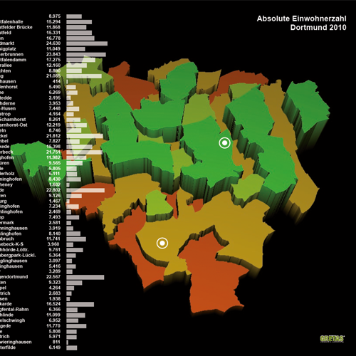
Spatial Analysis
Benefit from our tailor-made spatial analyses for your relevant locations and areas.
Why GRETASdata?
Easy Download
Quickly find relevant information for instant download.
Clear Information
Save yourself the tedious research on numerous individual portals.
GIS2CAD
Edit the data immediately in the CAD software of your choice.
No Space Limits
Choose your individual analysis area for each project.
Choose a Plan
Up-to-date and well-founded geodata ready for immediate use. Our database and analysis offer is growing continuously. Benefit from our offers according to your needs.
* Alle Preise sind inkl. 19% MwSt.
Ein Wechsel zwischen den Abonnements und eine Kündigung ist jederzeit möglich. Es gelten unsere Terms of Use.
Free-Plan:
Beschränkung auf 1 km2
Try our Test Data
We offer DXF data * for free download, no registration necessary.
You can find more data sets here.
* Downloaddaten beinhalten das OSM-Straßennetz als Polygon-Linien.
Application Examples